f. 17r., entire face of one folio (pictorial and textual)
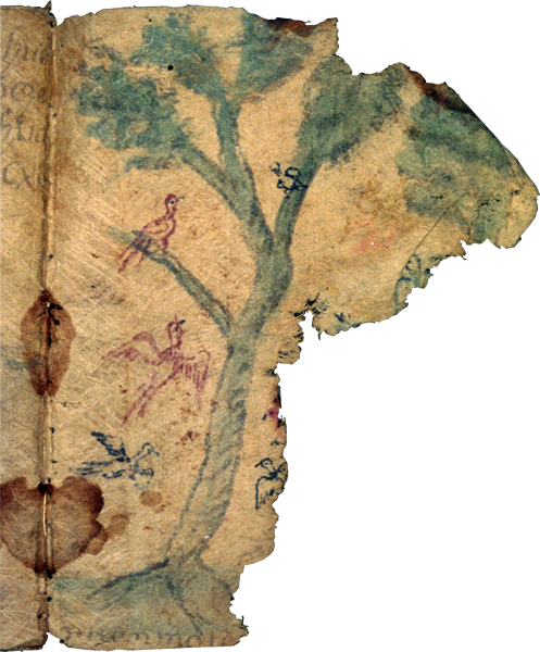
This page, which is the front side of the seventeenth folio (17 recto) of eighteen folios, is typical of the image-heavy pages that feature landscapes included in these territorial claims of San Cristóbal Texcalucan and Santa María Magdalena Chichicaspa in the municipality of Huixquilucan (modern State of Mexico) late in the Spanish colonial period.
The imagery on this page includes what appears to be two trees, possibly some additional greenery, and four or five birds birds.
Very little text appears on this page, and it is difficult to make out. According to the Spanish translation, some more text once did appear on the right margin page as well. It is now torn away. The text referred to toponyms “Tototlan” and “Atlahueytec,” and stated that there were 300 “cordeles” of land in this place pertaining to the people of Santa María Magdalena.
The page is torn nearly in half, with the lower right corner and much more missing. It apparently eroded as a result of being nearly the final page of the manuscript, exposed to wear and tear. There are brown stains in the binding, and evidence of stains in the upper right corner and top middle of the page.
página entera de un folio (pintura y texto)
Esta página, que es la parte delantera del folio diecisiete (17 verso) de dieciocho folios, es típica de las páginas con imagen-pesada que documenta paisajes incluyendo estos reclamos territoriales de San Cristóbal Texcalucan y Santa María Magdalena Chichicaspa en el municipio de Huixquilucan (Estado de México) posteriormente en el período colonial Español.
Las imágenes en esta página incluyen lo que parece ser dos árboles, posiblemente algunos follajes, y cuatro o cinco pájaros.
Muy poco texto aparece en esta página, y es difícil de verlo. De acuerdo con la traducción en Español, algunos otros textos aparecierón algún día en el margen derecho de la página. La que esta rota ahorita. El texto se refiere a topónimos “Tototlan” y “Atlahueytec,” y decía que habían 300 “cordeles” de tierra en este lugar, perteneciendo a la gente de Santa María Magdalena.
La página esta casi rota a la mitad, con la esquina derecha de abajo y mucho más desaparecida. Parece que se erosionó como resultado de ser casi la última página del manuscrito, expuesto a desgastarse y romperse. Hay mnchas cafes en la cobertura, y evidencia de manchas en la esquina derecha de arriba y en medio de la página en la parte de arriba.