full view, Toluca area
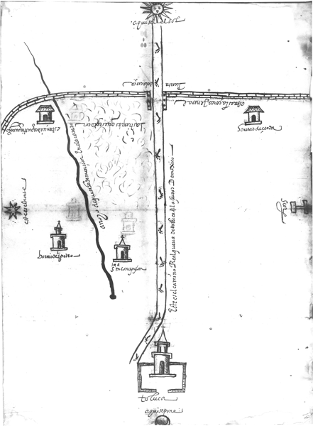
This map shows East at what appears to be the top of the map, and West is at the bottom, where we see a glyph-like symbol for the city of Toluca, with a church and atrium. Two nearby communities are also visible, both lying on the northern side of the road that connects Toluca to Mexico City. These are Santa María Concepción and the “barrio de San Pedro.” They may both bear the name Totoltepec today. We also see the sixteenth-century wall running north and south across the top third of the map. There is a spring from which water flows along an arroyo, which starts slightly north and east of Toluca and runs to the wall and beyond. This map may have been made primarily to highlight some lands that were being requested (through grant or purchase, presumably), to the east of Concepción, south of the arroyo, north of the main road to Mexico City, and west of the wall. [SW]