 |
|
|
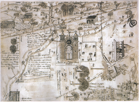
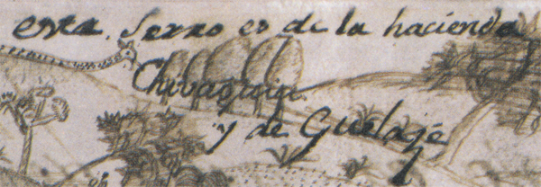
este serro es de la hacienda Chiva.... y de Guelazé |
|
|
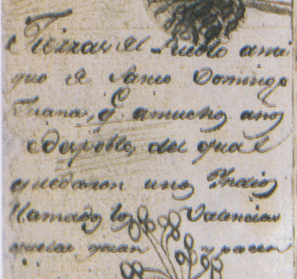 |
[Transcription by Stephanie Wood:] Tierras del Pueblo antiguo de Santo Domingo Luana(?), que a muchos años [s]e despoblo, del qual quedaron unos Yndios llamados los Valencias que las gozan y poseen |
[Translation from Spanish to English by Stephanie Wood:] [These are the] lands of the old town of Santo Domingo Luana(?), which became depopulated many years ago, [but] from which remained some Indians called the Valencias, who enjoy and possess them [today, i.e. in the 1690s]. |
|
|
|
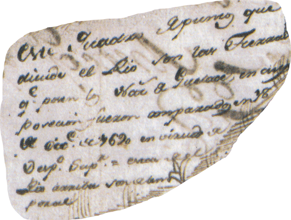 |
[Transcription of the Spanish by Stephanie Wood:] este quadro de punto que divide el Rio con las Tierras que pose[e]n los Naturales de Guelace, en cuya posecion fueron amparados en 18 de Diciembre de 1690 en virtud de Despacho Superior. estan de el Rio arriba son de temporal |
[Spanish-to-English translation by Stephanie Wood:] This quarter point divides the river from the lands that belong to the indigenous people of Guelace, in whose possession they were protected by a High Dispatch on December 18, 1690. They [the lands in question] are from the river going up. They are irrigated only by rain. |
|
|
|